Puerto Rico Chart Bundle (Dominican Republic to S.V.I.) Reg. 11.1 w/CD & App
Store Price:
$132.05
Export Price
$118.85
In stock
SKU
BB00010
Brand: N.V. Charts
Vendor SKU: REGION 11.1
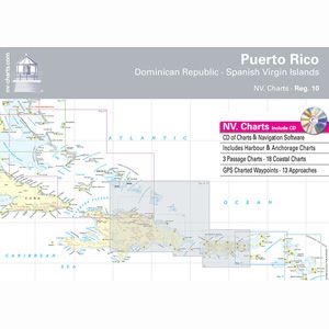
NV Charts feature fine contours and easy to distinguish color gradations of the depth line, turquoise for coral reefs, red for the two meter line, and blue for the five meter areas. They're a manageable size for both small and large boats 23 1/2" by 16 1/2" sheets packaged in a thick plastic envelope. A magnifier and key to symbols are included. Also featured is good land topography with well marked rivers, towns, and street plans to assist with eyeball navigation. They also give a clear overall view of the shore side facilities that are available. Waypoints are highlighted in red, all charts are adjusted to WGS84 datum. Heights and depths are in meters. All area charts are scaled consistently 1:90,000 and passage charts are at 1:500,000. Large scale approaches and land contour markings simplify harbor approaches. Charts are coordinated with Chris Doyle's well known cruising guides for the Virgin, Leeward, and Windward Islands.